![Severe Weather Likely in East Texas This Afternoon [UPDATED]](http://townsquare.media/site/187/files/2013/01/weather1-630x472.jpg?w=980&q=75)
Severe Weather Likely in East Texas This Afternoon [UPDATED]
UPDATE 8:10pm
Severe Thunderstorm Warning for Cherokee County until 9:15pm
UPDATE 6:30pm
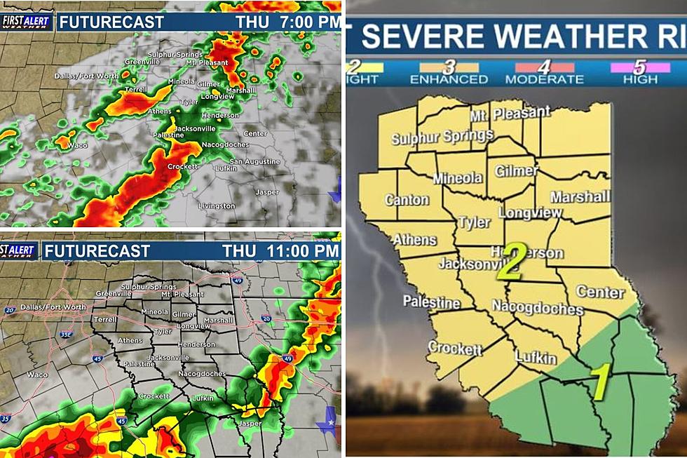
Tornado watch extended until 1:00a and now includes Camp, Cass, Framklin, Gregg, Harrison, Marion, Morris, Smith, Titus, Upshur, Wood, Nacogdoches, Shelby, Cherokee, Panola and Rusk.
Severe Thunderstorm Warnings in effect until 7:00pm for Franklin, Red River and Titus Counties and until 7:30pm for Smith and Wood Counties.
UPDATE 1:30pm
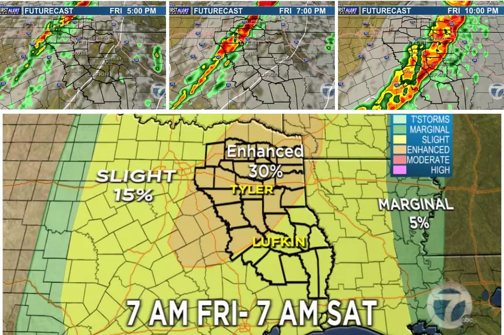
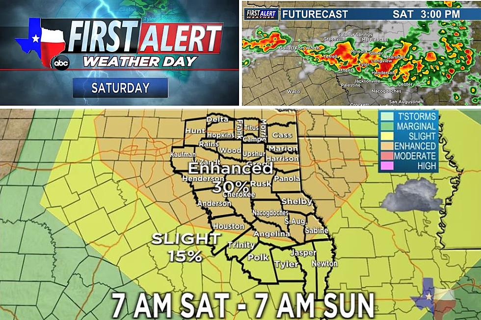
All of East Texas has been put under a slight risk for severe weather this afternoon. Areas from Titus County southeastward to Marshall are under a moderate risk. A Tornado watch remains in effect until 7pm for areas along and north of Interstate 20.
UPDATE 11:30am
A tornado watch has been issued until 7pm for parts of East Texas along and north of Interstate 20. This watch includes the following counties: BOWIE, CAMP, CASS, FRANKLIN, GREGG, HARRISON, MARION, MORRIS, RED RIVER, SMITH, TITUS, UPSHUR and WOOD
Quarter size hail, winds in excess of 70 mph and isolated tornadoes are possible across East Texas this afternoon (Jan. 29). The main threat is early this afternoon north of Interstate 20 ahead of the main line of storms which should move through the area later this afternoon and into the evening.
KLTV 7 Meteorologist Grant Dade says the greatest tornado threat is still to our east in Louisiana and Arkansas. The main concern is going to be the gusty winds.
Grant says the line of storms can be expected around 4 to 6 p.m. this afternoon in the Tyler and Longview areas, and Around 6 to 8 p.m. for deep East Texas.
More From 107-3 KISS-FM

![Scary Footage Shows Motorists Fleeing Grapevine, TX Tornado [VIDEO]](http://townsquare.media/site/156/files/2022/12/attachment-grapevine-tornado.jpg?w=980&q=75)